18 resultater (0,22243 sekunder)

Mærke

Butik

Pris (EUR)

Nulstil filter

Produkter
Fra
Butikker

CAA2014: 21st Century Archaeology - - Bog - Archaeopress - Plusbog.dk

Visualizing cityscapes of Classical antiquity: from early modern reconstruction drawings to digital 3D models - Chiara Piccoli - Bog - Archaeopress -

Visualizing cityscapes of Classical antiquity: from early modern reconstruction drawings to digital 3D models - Chiara Piccoli - Bog - Archaeopress -

The amount of 3D modelling applications in archaeology has increased enourmously over the last decade. 3D recording techniques allow researchers to quickly and accurately document archaeological evidence, and 3D reconstructions have created new possibilities to communicate the results to a larger public. In this latter case, however, numerous scholars have expressed their concern regarding the ethics of such digital representations, since they give prominence to a crystallized image of the past and do not account for the complexity of the archaeological record. The study presented here aims to make a practical contribution to a new understanding and use of 3D reconstructions, namely as ‘laboratories’ to test hypotheses and visualize, evaluate and discuss alternative interpretations. In order to do so, an analysis of visual reconstructions of the early and late modern period is presented first, followed by a discussion of current applications of 3D digital reconstructions, with a special focus on cityscapes. Lastly, a practical implementation of a research-driven, intellectually transparent and GIS-based 3D reconstruction is proposed for the urban site of Koroneia, in Boeotia, Central Greece. Specifically, the methodology developed in this work uses tools that are employed in geo-design and modern urban planning in an innovative way, integrating GIS with a rule-based modelling approach. With a strong focus on the automation and iteration of the reconstruction process, our 3D visualization provides an intuitive insight into hidden relationships and associations among data, and allows the creation and evaluation of alternative reconstruction hypotheses.

DKK 701.00
1

Best Practices of GeoInformatic Technologies for the Mapping of Archaeolandscapes - - Bog - Archaeopress - Plusbog.dk

Journal of Greek Archaeology Volume 9 2024 - - Bog - Archaeopress - Plusbog.dk

Approaches to the Analysis of Production Activity at Archaeological Sites - - Bog - Archaeopress - Plusbog.dk

Mapping Society: Settlement Structure in Later Bronze Age Ireland - Victoria Ruth Ginn - Bog - Archaeopress - Plusbog.dk

Assessing Iron Age Marsh-Forts - Shelagh Norton - Bog - Archaeopress - Plusbog.dk

Assessing Iron Age Marsh-Forts - Shelagh Norton - Bog - Archaeopress - Plusbog.dk

Iron Age marsh-forts are large, monumental structures located in low-lying waterscapes. Although they share chronological and architectural similarities with their hillfort counterparts, their locations suggest that they may have played a specific and alternative role in Iron Age society. Despite the availability of a rich palaeoenvironmental archive at many sites, little is known about these enigmatic structures, and until recently, the only acknowledged candidate was the unusual, dual-enclosure monument at Sutton Common, near Doncaster. Assessing Iron Age Marsh-Forts considers marsh-forts as a separate phenomenon within Iron Age society through an understanding of their landscape context and palaeoenvironmental development. At the national level, a range of Iron Age wetland monuments has been compared to Sutton Common to generate a gazetteer of potential marsh-forts. At the local level, a multi-disciplinary case-study is presented of the Berth marsh-fort in North Shropshire, incorporating GIS-based landscape modelling and multi-proxy palaeoenvironmental analysis (plant macrofossils, beetles and pollen).The results of both the gazetteer and the Berth case-study challenge the view that marsh-forts are simply a topographical phenomenon. These substantial Iron Age monuments appear to have been deliberately constructed to control areas of marginal wetland and may have played an important role in the ritual landscape.

DKK 451.00
1

A Landscape of Conflict? Rural Fortifications in the Argolid (400–146 BC) - Anna Magdalena Blomley - Bog - Archaeopress - Plusbog.dk

A Landscape of Conflict? Rural Fortifications in the Argolid (400–146 BC) - Anna Magdalena Blomley - Bog - Archaeopress - Plusbog.dk

A Landscape of Conflict? Rural Fortifications in the Argolid (400–146 BC) is the first systematic study of Late Classical and Hellenistic rural fortifications in the territories of ancient Argos and the city-states of the Argolic Akte (northeastern Peloponnese). Based on one of the largest regional corpora of Greek fortified sites to date, the volume investigates the function of rural fortifications by placing them in the context of their surrounding landscape. This approach – combining ‘traditional’ methods of ancient history and landscape archaeology with GIS-based data analyses – helps to readdress the long-standing tension between ‘military-strategic’ and ‘non-military’ research agendas in Greek fortification studies, and highlights that Classical and Hellenistic rural fortifications are neither a priori fortified farmsteads nor parts of military-strategic networks of territorial defence. Instead, rural fortifications emerge in this monograph as multifunctional and multifaceted sites, which open a new window into different forms of ‘formal’ and ‘informal’ conflict in the ancient countryside and bear witness to a remarkable degree of local motivation and agency. The study thus demonstrates how ancient fortifications can provide an unexpected and so far much underappreciated opportunity for writing local or regional Greek histories – political and military as well as social and economic – from archaeological sources.

DKK 654.00
1

Irish Late Iron Age Equestrian Equipment in its Insular and Continental Context - Rena (queen's University Belfast) Maguire - Bog - Archaeopress -

Irish Late Iron Age Equestrian Equipment in its Insular and Continental Context - Rena (queen's University Belfast) Maguire - Bog - Archaeopress -

Irish Late Iron Age Equestrian Equipment in its Insular and Continental Context is the first practical archaeological study of Irish Iron Age lorinery. The volume examines the bits and bosals (Y-pieces) holistically, using practical stable-yard knowledge merged with archaeological techniques such as morphometrics, use-wear, GIS, functional comparison to European and British equipment and distribution analysis to place it within its time and place. Irish Iron Age artefacts have always been beset by issues of chronology, but by using these various analytical methods, a more precise timeframe for the objects is indicated. A complex relationship with Roman Britain and the Empire also becomes visible, with aspects of identity and belief being expressed through the sophisticated equestrian equipment. The analysis of the bridle components reveal that the Ireland of the first centuries AD shares some characteristics with other boundary zones of the Roman Empire, such as Scotland and northern Germany, but also has its own unique interpretation of introduced technology. The Ireland of the Late Iron Age, then, is a society in flux, picking and choosing which traditions it maintains. The horse and associated equipment were very much at the heart of the social changes set in motion by contact with the Roman Empire, and as such, the examination of the snaffles and bosals allows us to bring the people of the Late Iron Age in Ireland into focus.

DKK 523.00
1

CAA2016: Oceans of Data - - Bog - Archaeopress - Plusbog.dk

CAA2016: Oceans of Data - - Bog - Archaeopress - Plusbog.dk

CAA2016: Oceans of Data gives an up-to-date overview of the field of archaeology and informatics. It presents ground-breaking technologies and best practice from various archaeological and computer science disciplines. The articles in this volume are based on the foremost presentations from the 44th Computer Applications in Archaeology Conference 2016, held in Oslo. The theme of CAA2016 was ‘Exploring Oceans of Data’, alluding to one of the greatest challenges in this field: the use and reuse of large datasets that result both from digitalisation and digital documentation of excavations and surveys. The volume contains 50 peer-reviewed and highest-ranked papers that are divided in eight parts, including an introduction and seven chapters. The introduction sets the stage with Oceans of Data (C.-E. Ore) and Theorising the Digital (S. Perry and J. S.Taylor), discussing the current status of overall CAA research. These two papers present the current developments, challenges, and potential that lies ahead from different perspectives. Ore points to the importance of common authority systems and ontologies. Common conceptual data models will ease curation and secure long-term reusability. Perry and Taylor address the need to bring together theoretical and digital archaeology. In the following chapters, different topics are presented under the headings Ontologies and Standards , Field and Laboratory Data Recording and Analysis , Archaeological Information Systems , GIS and Spatial Analysis , 3D and Visualisation , Complex Systems Simulation , and Teaching Archaeology in the Digital Age .

DKK 903.00
1

Physical Barriers, Cultural Connections: A Reconsideration of the Metal Flow at the Beginning of the Metal Age in the Alps - Laura Perucchetti - Bog -

Physical Barriers, Cultural Connections: A Reconsideration of the Metal Flow at the Beginning of the Metal Age in the Alps - Laura Perucchetti - Bog -

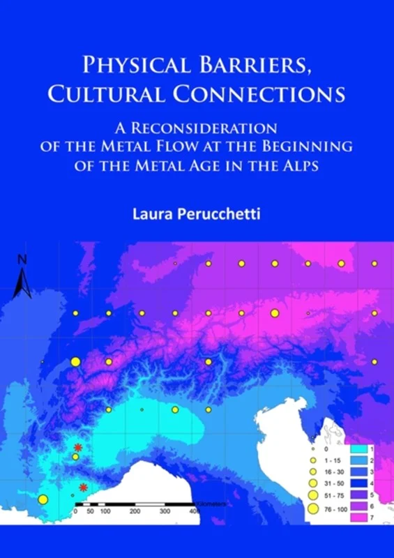
Physical Barriers, Cultural Connections: A Reconsideration of the Metal Flow at the Beginning of the Metal Age in the Alps considers the early copper and copper-alloy metallurgy of the entire Circum- Alpine region. It introduces a new approach to the interpretation of chemical composition data sets, which has been applied to a comprehensive regional database for the first time. An extensive use of GIS has been applied to investigate the role of topography in the distribution of metal and to undertake spatial and geostastical analysis that may highlight patterns of distribution of some specific key compositional element. The Circum-Alpine Chalcolithic and Early Bronze Age show some distinctively different patterns of metal use, which can be interpreted through changes in mining and social choices. But there are also some signs of continuity, in particular those which respect the use of major landscape features such as watersheds and river systems. Interestingly, the Alpine range does not act as a north-south barrier, as major differences in composition tend to appear on an east-west axis. Conversely, the river system seems to have a key role in the movement of metal. Geostastical analyses demonstrate the presence of a remelting process, applicable also in the case of ingots; evidence that opens new and interesting questions about the role of ingots and hoards in the distribution of metal at the beginning of the Metal Age. New tools and new analysis may also be useful to identify zones where there was a primary metal production and zones where metal was mostly received and heavily manipulated.

DKK 416.00
1

Journal of Greek Archaeology Volume 6 2021 - - Bog - Archaeopress - Plusbog.dk

Journal of Greek Archaeology Volume 6 2021 - - Bog - Archaeopress - Plusbog.dk

Volume 6 maintains the journal''s goal to cover the broad chronological spread of Greek Archaeology, ranging from a new review of the Mesolithic occupation at Theopetra, one of the most important hunter-gatherer sites in Greece, to a detailed analysis of how the distribution of Middle Byzantine churches in the Peloponnese enlightens us into the evolution of human settlement and land use. Prehistory is richly represented in further articles, as we learn about Middle Bronze Age society on Lefkas, the dispute over exotic primates portrayed on the frescoes of Santorini, a new Minoan-style peak sanctuary on Naxos, and Post-Palatial settlement structure on Crete. Bridging prehistory to historical times, a detailed study rethinks the burial and settlement evidence for Early Iron Age Athens, then entering the Archaic period, an original article links textual analysis and material culture to investigate dedicatory behaviour in Ionian sanctuaries. As a special treat, that doyen of Greek plastic arts Andrew Stewart, asks us to look again at the evidence for the birth of the Classical Style in Greek sculpture. Greek theatres in Sicily are next contextualised into contemporary politics, while the sacred Classical landscape of the island of Salamis is explored with innovative GIS-techniques. For the seven-hundred years or so of Roman rule we are given an indepth presentation of regional economics from Central Greece, and a thorough review of harbours and maritime navigation for Late Roman Crete. Finally we must mention a methodological article, deploying the rich data from the Nemea landscape survey, to tackle issues of changing land use and the sometimes controversial topic of ancient manuring.

DKK 951.00
1

Hillforts, Warfare and Society in Bronze Age Ireland - James O'driscoll - Bog - Archaeopress - Plusbog.dk

Hillforts, Warfare and Society in Bronze Age Ireland - James O'driscoll - Bog - Archaeopress - Plusbog.dk

The later part of the Bronze Age (1500-700 BC) was a time of settlement expansion and economic prosperity in Ireland. This was a landscape of small autonomous farming communities, but there is also evidence for control of territory and population, involving centralized organization of trade and economy, ritual and military force. That concentration of power was connected to the emergence of chiefdom polities active in the consolidation of large regional territories. Their competitive tendencies led on occasion to conflict and warfare, at a time of growing militarism evident in the mass production of bronze weaponry, including the first use of swords. Hillforts are another manifestation of a warrior culture that emerged not only in Ireland but across Europe during the Middle and Late Bronze Age. They were centers for high-status residence, ceremony and assembly, and represented an important visual display of power in the landscape. This is the first project to study hillforts in relation to warfare and conflict in Bronze Age Ireland. New evidence for the destruction of hillforts is connected to territorial disputes and other forms of competition arising from the ambitions of regional warlords, often with catastrophic consequences for individual communities. This project combines remote sensing and GIS-based landscape analysis with conventional archaeological survey and excavation, to investigate ten prehistoric hillforts across southern Ireland. These include a cluster of nine examples at Baltinglass, Co. Wicklow, often termed ‘Ireland’s hillfort capital’. The results provide new insights into the design and construction of these immense sites, as well as details of their occupation and abandonment. The chronology of Irish hillforts is reviewed, with a new understanding of origins and development. The project provides a challenging insight into the relationship of hillforts to warfare, social complexity and the political climate of late prehistoric Ireland.

DKK 772.00
1

Athens and Attica in Prehistory: Proceedings of the International Conference, Athens, 27–31 May 2015 - - Bog - Archaeopress - Plusbog.dk

Athens and Attica in Prehistory: Proceedings of the International Conference, Athens, 27–31 May 2015 - - Bog - Archaeopress - Plusbog.dk

The numerous rescue excavations conducted in Athens and Attica by the Archaeological Service during and after the major construction projects of the 2004 Olympic Games brought to light significant new prehistoric finds which have transformed our understanding of the region in prehistory. However, despite their importance, the new discoveries had remained mostly unnoticed by the international community, as the results were scattered in various publications, and no synthesis was ever attempted. The goal of the 2015 international conference Athens and Attica in Prehistory, which was organized by the American School of Classical Studies at Athens, the University of Athens (Department of Archaeology and History of Art), the Museum of Cycladic Art and the Ephorate of Antiquites of East Attica (Hellenic Ministry of Culture) was to gather scholars working in the region and present for the first time a survey of Attic prehistory which would include the most recent discoveries and integrate over a century of scholarship. The 668- page conference proceedings include over 66 papers in Greek and English with sections dedicated to topography, the palaeo-environment, the Neolithic, the Chalcolithic transition, the Early Bronze Age, the Middle and Late Bronze Age, as well as the contacts between Attica and its neighbouring regions. A series of new detailed maps, derived from an exhaustive GIS-related database, provide the most up to date topographical and archaeological survey of Prehistoric Attica. Athens and Attica in Prehistory provides the most complete overview of the region from the Neolithic to the end of the Late Bronze Age. Its importance goes beyond the field of Aegean prehistory, as it paves the way for a new understanding of Attica in the Early Iron Age and indirectly throws new light on the origins of what will later become the polis of the Athenians.

DKK 1087.00
1

3D Delineation: A modernisation of drawing methodology for field archaeology - Justin J.l. Kimball - Bog - Archaeopress - Plusbog.dk

3D Delineation: A modernisation of drawing methodology for field archaeology - Justin J.l. Kimball - Bog - Archaeopress - Plusbog.dk

A recent trend concerning archaeological research has focused on producing a real-time methodology for 3D digital models as archaeological documentation within the excavation setting. While such methodologies have now firmly been established, what remains is to examine how 3D models can be integrated more fully alongside other forms of archaeological documentation. This work explored one avenue by developing a method that combines the interpretative power of traditional archaeological drawings and the realistic visualisation capacity of 3D digital models. An experiment was initiated during archaeological excavations at Uppåkra, Sweden where photographic data was captured to produce 3D digital models through Photoscan. These models were geospatially located within ESRI’s 3D GIS ArcScene where shapefile editing tools were used to draw overtop of their surfaces in three-dimensions. All drawings closely followed the single context method of drawing, were allotted context numbers, and given descriptive geodatabase attributes. This methodology resulted in the further integration of 3D models alongside other forms of archaeological documentation. The drawings increased the communicative powers of archaeological interpretation by enabling the information to be disseminated in a 3D environment alongside other formats of data that would have otherwise been disconnected in 2D space. Finally, the database attributes permitted the drawings complete integration within the geodatabase, thereby making them available for query and other analytical procedures. Archaeological information is three-dimensional; therefore, archaeologists must begin to approach documentation bearing this in mind. This technique has demonstrated that 3D models are a fluidic form of documentation allowing for accurate preservation of archaeology while enabling new forms of data to be derived all within a limited amount of time. Archaeologists must begin to affect change towards embracing 3D models and their associated applications as a standard tool within the excavator’s toolbox.

DKK 285.00
1

Hillforts: Britain, Ireland and the Nearer Continent - - Bog - Archaeopress - Plusbog.dk

Hillforts: Britain, Ireland and the Nearer Continent - - Bog - Archaeopress - Plusbog.dk

Funded by the AHRC, the Atlas of Hillforts of Britain and Ireland project (2012-2016) involved a team drawn from the Universities of Oxford, Edinburgh and Cork which was responsible for compiling a massive database, now freely available online at https://hillforts.arch.ox.ac, on hillforts in Britain and Ireland. This was underpinned by a major desk-based re-assessment of accessible records. These twelve studies, presented at the end of that exercise to a conference in Edinburgh, and contributed by team members and colleagues, outline the background to and development of the project (Gary Lock) and offer a preliminary assessment of the online digital Atlas (John Pouncett) as well as presenting initial research studies using Atlas data. The volume is profusely illustrated with over 140 figures, including many new maps. Ian Ralston provides a historical assessment of key stages in the enumeration and mapping of these important monuments on both sides of the Irish Sea. The hill- and promontory forts of England, Wales and the Isle of Man are assessed by Ian Brown and those of Ireland by James O’Driscoll, Alan Hawkes and William O’Brien. Stratford Halliday’s study of the Scottish evidence focuses on the impact of the application of the Atlas criteria to the records of forts in that country. Simon Maddison deploys Percolation Analysis as an example of the potential re-use of the Atlas data in analysing new distributions; Jessica Murray presents a GIS-based approach to hillfort settings and configurations. Syntheses on insular Early Historic fortified settlements in northern Britain and Ireland, by James O’Driscoll and Gordon Noble, and on hillforts in areas of the nearer Continent are included. The latter comprise an overview by Sophie Krausz on Iron Age fortifications in France and a consideration of the south German records of hillforts and oppida by Axel Posluschny, while Fernando Rodriguez del Cueto tackles the north-western Spanish evidence.

DKK 534.00
1

Materials, Productions, Exchange Network and their Impact on the Societies of Neolithic Europe - - Bog - Archaeopress - Plusbog.dk

Materials, Productions, Exchange Network and their Impact on the Societies of Neolithic Europe - - Bog - Archaeopress - Plusbog.dk

Scholars who will study the historiography of the European Neolithic, more particularly with regards to the second half of the 20th century and the beginning of the 21st century, will observe a progressive change in the core understanding of this period. For several decades the concept of ‘culture’ has been privileged and the adopted approach aimed to highlight the most significant markers likely to emphasise the character of a given culture and to stress its specificities, the foundations of its identity. In short, earlier research aimed primarily to highlight the differences between cultures by stressing the most distinctive features of each of them. The tendency was to differentiate, single out, and identify cultural boundaries. However, over the last few years this perspective has been universally challenged. Although regional originality and particularisms are still a focus of study, the research community is now interested in widely diffused markers, in medium-scale or large-scale circulation, and in interactions that make it possible to go beyond the traditional notion of ‘archaeological culture’. The networks related to raw materials or finished products are currently leading us to re-think the history of Neolithic populations on a more general and more global scale. The aim is no longer to stress differences, but on the contrary to identify what links cultures together, what reaches beyond regionalism in order to try to uncover the underlying transcultural phenomena. From culturalism, we have moved on to its deconstruction. This is indeed a complete change in perspective. This new approach certainly owes a great deal to all kinds of methods, petrographic, metal, chemical and other analyses, combined with effective tools such as the GIS systems that provide a more accurate picture of the sources, exchanges or relays used by these groups. It is also true that behind the facts observed there are social organisations involving prospectors, extractors, craftsmen, distributors, sponsors, users, and recyclers. We therefore found it appropriate to organise a session on the theme ‘Materials, productions, exchange networks and their impact on the societies of Neolithic Europe’. How is it possible to identify the circulation of materials or of finished objects in Neolithic Europe, as well as the social networks involved? Several approaches exist for the researcher, and the present volume provides some examples.

DKK 285.00
1

Proceedings of the Seminar for Arabian Studies Volume 40 2010 - - Bog - Archaeopress - Plusbog.dk

Proceedings of the Seminar for Arabian Studies Volume 40 2010 - - Bog - Archaeopress - Plusbog.dk

Volume Contents: The Qatar National Historic Environment Record: a bespoke cultural resource management tool and the wider implications for heritage management within the region (Rebecca Beardmore et al.); Preliminary pottery study: Murwab horizon in progress, ninth century AD, Qatar (Alexandrine Guérin); Excavations and survey at al-Ruwaydah, a late Islamic site in northern Qatar (Andrew Petersen & Tony Grey); Al-Zubārah and its hinterland, north Qatar: excavations and survey, spring 2009 (Alan Walmsley et al.); A possible Upper Palaeolithic and Early Holocene flint scatter at Ra''s Ushayriq, western Qatar (Faisal Abdulla Al-Naimi et al.); The dhow’s last redoubt? Vestiges of wooden boatbuilding traditions in Yemen (Dionisius A. Agius et al.); Building materials in South Arabian inscriptions: observations on some problems concerning the study of architectural lexicography (Alessio Agostini); Conflation of celestial and physical topographies in the Omani decorated mihrāb (Soumyen Bandyopadhyay); Al-Balīd ship timbers: preliminary overview and comparisons (Luca Belfioretti & Tom Vosmer); Fouilles à Masāfī-3 en 2009 (Émirat de Fujayrah, Émirats Arabes Unis): premières observations à propos d’un espace cultuel de l’Âge du Fer nouvellement découvert en Arabie orientale (Anne Benoist); First investigations at the Wādī al-Ayn tombs, Oman (poster) (Manfred Böhme); Glass bangles of al-Shīhr, Hadramawt (fourteenth–nineteenth centuries), a corpus of new data for the understanding of glass bangle manufacture in Yemen (Stéphanie Boulogne & Claire Hardy-Guilbert); L’emploi du bois dans l’architecture du Yémen antique (Christian Darles); Once more on the interpretation of mtl in Epigraphic South Arabian (a new expiatory inscription on irrigation from Kamna) (Serge A. Frantsouzoff); New evidence on the use of implements in al-Madām area, Sharjah, UAE (Alejandro Gallego López); The first three campaigns (2007-2009) of the survey at Ādam (Sultanate of Oman) (Jessica Giraud et al.); A new approach to central Omani prehistory (Reto Jagher & Christine Pümpin); Umm an-Nar settlement in the Wādī Andam (Sultanate of Oman) (Nasser al-Jahwari & Derek Kennet); Mapping Masna at Māryah: using GIS to reconstruct the development of a multi-period site in the highlands of Yemen (Krista Lewis et al.); Written Mahri, Mahri fusha and their implications for early historical Arabic (Samuel Liebhaber); How difficult is it to dedicate a statue? A new approach to some Sabaic inscriptions from Mahrib (Anne Multhoff); The semantic structure of motion verbs in the dialect of Zabīd (Yemen) (Samia Naïm); Preliminary results of the Dhofar archaeological survey (Lynne S. Newton & Juris Zarins); An early MIS3 wet phase at palaeolake Κaqabah: preliminary interpretation of the multi-proxy record (Ash Parton et al.); South Arabian inscriptions from the Farasān Islands (Saudi Arabia) (Solène Marion de Procé & Carl Phillips); The ‘River Aftan’: an old caravan/trade route along Wādī al-Sahbām (Nabiel Y. Al Shaikh & Claire Reeler); The Wādī Sūq pottery: a typological study of the pottery assemblage at Hili 8 (UAE) (Sabrina Righetti & Serge Cleuziou); A Βarf talisman from Ghayl Bā Wazīr, Hadramawt (Mikhail Rodionov); The Qalhāt Project: new research at the medieval harbour site of Qalhāt, Oman (2008) (Axelle Rougeulle); Irrigation management in pre-Islamic South Arabia according to the epigraphic evidence (Peter Stein); A detective story: emphatics in Mehri (Janet C.E. Watson & Alex Bellem); Shell mounds of the Farasān Islands, Saudi Arabia (M.G.M. Williams); The Almaqah temple of Meqaber Ga''ewa near Wuqro (Tigray, Ethiopia) (Pawel Wolf & Ulrike Nowotnick).

DKK 654.00
1