28 results (0,16441 seconds)

Brand

Colour

Size

Merchant

Price (EUR)

Reset filter

Products
From
Shops

GIS A Computing Perspective

GIS A Computing Perspective

Following two successful editions the third edition of GIS: A Computing Perspective has been completely revised and updated with extensive new content reflecting the significant progress that has been made in the realm of GIS within the last 20 years. Major new topics covered for the first time in this edition include: graph databases and graph query languages ontology engineering and qualitative spatial reasoning geosensor networks and GeoAI decentralized computing and online algorithms and critical GIS and data sovereignty. Features Includes an entirely new chapter on AI and GIS including ontologies and the Semantic Web knowledge representation (KR) and spatial reasoning machine learning and spatial analysis and neural networks and deep learning Presents new material reflecting the advances made in cloud computing stream computing and sensor networks as well as extensively revised and updated content on cartography visualization and interaction design Connects the technology to the social aspects and implications of GIS including privacy and fair information practices FATE (fairness accountability transparency and ethics) and codes of conduct for responsible use of GIS Integrates the necessary background to foundational areas such as databases and data structures algorithms and indexes and system architecture and AI provided in context so readers new to those topics can still understand the concepts being discussed Incorporates over 20 carefully explained spatial algorithms; over 60 inset boxes with in-depth material that enriches the central topics; and more than 300 color figures to support the reader in mastering key concepts Welcomes a new coauthor Qian (Chayn) Sun to the third edition who brings her expertise in topics such as web mapping cloud computing critical geography and machine learning with big spatial data Intended for anyone interested in understanding GIS especially students taking upper-level undergraduate and graduate courses in computer science and geography as well as academics researchers practitioners and professionals working in the field and involved in advanced GIS projects. | GIS A Computing Perspective

GBP 100.00
1

GIS and Housing Principles and Practices

GIS and Housing Principles and Practices

GIS and Housing: Principles and Practices discusses one of the challenges that has not been addressed by Geographic Information Science thus far: how can we use GIS to deal with the complex issues underlying the housing crisis? This book provides GIS technicians and analysts with an overview of US housing challenges and examples of how to effectively integrate spatial thinking to address housing policy questions while simultaneously introducing housing policy analysts to advanced GIS concepts and techniques to create livable neighborhoods that include housing alternatives beyond the single family. Through numerous examples the authors advocate for a collaborative approach that encourages professionals policymakers and analysts across different ideological and political perspectives to confront the multifaceted housing crisis. Features: Examines the historical aspects of housing provision societal attitudes demographic shifts and government policies Bridges the gaps between housing professionals and GIS experts facilitating an interdisciplinary approach to address the housing crisis Explores different challenges that are facing urban suburban and rural neighborhoods in different US regions Provides professionals with the necessary tools for informed decision-making Proposes solutions that leverage the integrative capacity of GIS to address established housing issues. Advocates for denser housing alternatives to address issues of affordability supply shortages and homelessness This book is intended for graduate students and professionals in housing community development urban planning architecture and GIS and anyone curious about learning more about the American housing crisis. | GIS and Housing Principles and Practices

GBP 89.99
1

Understanding GIS through Sustainable Development Goals Case Studies with QGIS

Understanding GIS through Sustainable Development Goals Case Studies with QGIS

Understanding GIS through Sustainable Development Goals applies a pedagogical shift to learning GIS as the readers employ the concepts and methodologies on real-world problems. This book provides 16 case studies across most of the Sustainable Development Goals (SDGs) with step-by-step practical instructions using QGIS(Quantum Geographic Information System) an open-source software. It helps readers develop GIS skills on real-world data while learning the fundamentals including spatial data models projections and spatial databases different cartographic methods such as graduated symbology change maps and dynamic visualization as well as more intermediate and advanced spatial analysis such as geoprocessing multiple criteria analysis and spatial statistics. The topics chosen are taught in secondary and tertiary education institutions which make this a textbook for all students and educators. Features: Focuses on learning GIS through 16 real world case studies. Introduces an open-source software that can be used beyond the classroom. Analyzes Sustainable Development Goals in a global framework and provides an alternative approach to learning GIS. Supports both secondary and tertiary educators and improves GIS education at all levels. Contains a holistic range of case studies that extend across several disciplines from geography education environmental sciences geosciences natural sciences social sciences and digital humanities. This is a textbook for all students and educators providing 16 case studies across most of the SDGs with step-by-step practical instructions using QGIS an open-source software. | Understanding GIS through Sustainable Development Goals Case Studies with QGIS

GBP 89.99
1

GIS An Introduction to Mapping Technologies Second Edition

GIS An Introduction to Mapping Technologies Second Edition

The second edition of this introductory GIS textbook is thoroughly rewritten and updated to respond to the demand for critical engagement with technologies that address relevant issues across several disciplines preparing students for higher-level work in geotechnologies. Chapters are arranged to (1) build competence in fundamental skills (2) explore applications of higher-level managerial and analytical functions that are typically called upon in public nonprofit and private sector milieu and (3) propose and detail a template for organizing executing and completing a GIS project successfully. This interests all users from beginners to experienced professionals. Features: Uses the latest version of ArcGIS Pro (3. 0) to present a fully rewritten and updated text with diverse perspectives. Includes many real-world examples with urban planning environmental and social justice foci. Presents new discussions examples and lab materials on open-source GIS projects. Includes lab activities and data available for download from Support Materials. Junior and senior level undergraduate students taking courses in remote sensing and GIS applications studying in the fields of Geography Environmental Sciences Computer Science Urban Studies Public Health and Social Disciplines as well as researchers and academics in the same fields will all benefit from the information provided in the updated version of this book. | GIS An Introduction to Mapping Technologies Second Edition

GBP 89.99
1

Computational Methods and GIS Applications in Social Science

Computational Methods and GIS Applications in Social Science

This textbook integrates GIS spatial analysis and computational methods for solving real-world problems in various policy-relevant social science applications. Thoroughly updated the third edition showcases the best practices of computational spatial social science and includes numerous case studies with step-by-step instructions in ArcGIS Pro and open-source platform KNIME. Readers sharpen their GIS skills by applying GIS techniques in detecting crime hotspots measuring accessibility of primary care physicians forecasting the impact of hospital closures on local community or siting the best locations for business. FEATURES Fully updated using the latest version of ArcGIS Pro and open-source platform KNIME Features two brand-new chapters on agent-based modeling and big data analytics Provides newly automated tools for regionalization functional region delineation accessibility measures planning for maximum equality in accessibility and agent-based crime simulation Includes many compelling examples and real-world case studies related to social science urban planning and public policy Provides a website for downloading data and programs for implementing all case studies included in the book and the KNIME lab manual Intended for students taking upper-level undergraduate and graduate-level courses in quantitative geography spatial analysis and GIS applications as well as researchers and professionals in fields such as geography city and regional planning crime analysis public health and public administration. | Computational Methods and GIS Applications in Social Science

GBP 100.00
1

Computational Methods and GIS Applications in Social Science - Textbook and Lab Manual

Computational Methods and GIS Applications in Social Science - Textbook and Lab Manual

This set includes the third edition of Computational Methods and GIS in Social Science and the accompanying lab manual. It integrates GIS spatial analysis and computational methods for solving real-world problems in various policy-relevant social science applications. Thoroughly updated the third edition of the textbook and its accompanying lab manual showcase the best practices of spatial computational social science and include numerous new examples and case studies with step-by-step instructions in ArcGIS Pro and open-source platform KNIME. KNIME supports visual programming and multiple scripting languages such as R Python and Java. It helps readers sharpen their GIS skills by applying GIS techniques in detecting spatiotemporal crime hot spots measuring the accessibility of primary care physicians forecasting the impact of hospital closures on the local community or siting the best locations for business. Features Fully updated using the latest version of ArcGIS Pro and open-source platform KNIME Includes many compelling examples and real-world case studies related to social science urban planning and public policy with clear step-by-step instructions Provides newly automated programs for regionalization functional region delineation accessibility measures maximal accessibility equality problem and agent-based crime simulation Includes 22 case studies from USA and China that parallel the methods developed in the textbook and enable readers to easily replicate and expand their work Adds two new chapters on agent-based modeling and big data analytics Provides support materials for downloading data and programs for implementing all case studies included in the book and the KNIME lab manual This set is intended for upper-level undergraduate and graduate students taking courses in quantitative geography spatial analysis GIS applications in socioeconomic studies GIS applications in business location theory. Researchers in similar fields: geography city and regional planning sociology criminology public health and public administration. | Computational Methods and GIS Applications in Social Science - Textbook and Lab Manual

GBP 120.00
1

Handbook of Geospatial Artificial Intelligence

Handbook of Geospatial Artificial Intelligence

This comprehensive handbook covers Geospatial Artificial Intelligence (GeoAI) which is the integration of geospatial studies and AI machine (deep) learning and knowledge graph technologies. It explains key fundamental concepts methods models and technologies of GeoAI and discusses the recent advances research tools and applications that range from environmental observation and social sensing to natural disaster responses. As the first single volume on this fast-emerging domain Handbook of Geospatial Artificial Intelligence is an excellent resource for educators students researchers and practitioners utilizing GeoAI in fields such as information science environment and natural resources geosciences and geography. Features Provides systematic introductions and discussions of GeoAI theory methods technologies applications and future perspectives Covers a wide range of GeoAI applications and case studies in practice Offers supplementary materials such as data programming code tools and case studies Discusses the recent developments of GeoAI methods and tools Includes contributions written by top experts in cutting-edge GeoAI topics This book is intended for upper-level undergraduate and graduate students from different disciplines and those taking GIS courses in geography or computer sciences as well as software engineers geospatial industry engineers GIS professionals in non-governmental organizations and federal/state agencies who use GIS and want to learn more about GeoAI advances and applications.

GBP 150.00
1

Advances in Urbanism Smart Cities and Sustainability

Advances in Urbanism Smart Cities and Sustainability

While technology is developing at a fast pace urban planners and cities are still behind in finding effective ways to use technology to address citizen’s needs. Multiple aspects of sustainable urbanism are brought together in this book along with advanced technologies and their connections to urban planning and management. It integrates urban studies smart cities AI IoT remote sensing and GIS. Highlights include land use planning spatial planning and ecosystem-based information to improve economic opportunities. Urban planners and engineers will understand the use of AI in disaster management and the use of GIS in finding suitable landfill sites for sustainable waste management. Features Explains the process of urban heritage conservation including the process of urban renewal and its regeneration and the role of citizens in urban renewal planning and management. Includes several case studies highlighting urban environmental problems and challenges in developed and developing countries and the ways for converting urban areas into smart cities. Focuses on urban resources the supply of energy in smart cities and their proper management practices. Introduces the role of remote sensing GIS and IoT in making a smart city and meeting sustainable goals. Analyzes unique case studies their challenges and obstacles and proposes a set of factors to understanding smart city initiatives and projects. | Advances in Urbanism Smart Cities and Sustainability

GBP 145.00
1

3S Technology Applications in Meteorology Observations Methods and Modelling

3S Technology Applications in Meteorology Observations Methods and Modelling

Spatial information technology and its integration such as remote sensing geographic information systems (GIS) and global navigation satellite systems (GNSS) known as 3S technology have been extensively utilized in managing and monitoring natural disasters. This book illustrates the 3S integrated applications in the field of meteorology and promotes the role of 3S in developing precise and intelligent meteorology. It presents the principles of 3S technology and the methods for monitoring different meteorological disasters and hazards as well as their application progress. The case studies from the United States Japan China and Europe were conducted to help all countries understand the 3S technology functions in handling and monitoring severe meteorological hazards. FEATURES Presents integral observations from GNSS GIS and remote sensing in estimating and understanding meteorological changes Explains how to monitor and retrieve atmospheric parameter changes using GNSS and remote sensing Shows three-dimensional modelling and evaluations of meteorological variation processing based on GIS Helps meteorologists develop and use space-air-ground integrated observations for meteorological applications Illustrates the practices in monitoring meteorological hazards using space information techniques and case studies This book is intended for academics researchers and postgraduate students who specialize in geomatics atmospheric science and meteorology as well as scientists who work in remote sensing and meteorology and professionals who deal with meteorological hazards. | 3S Technology Applications in Meteorology Observations Methods and Modelling

GBP 145.00
1

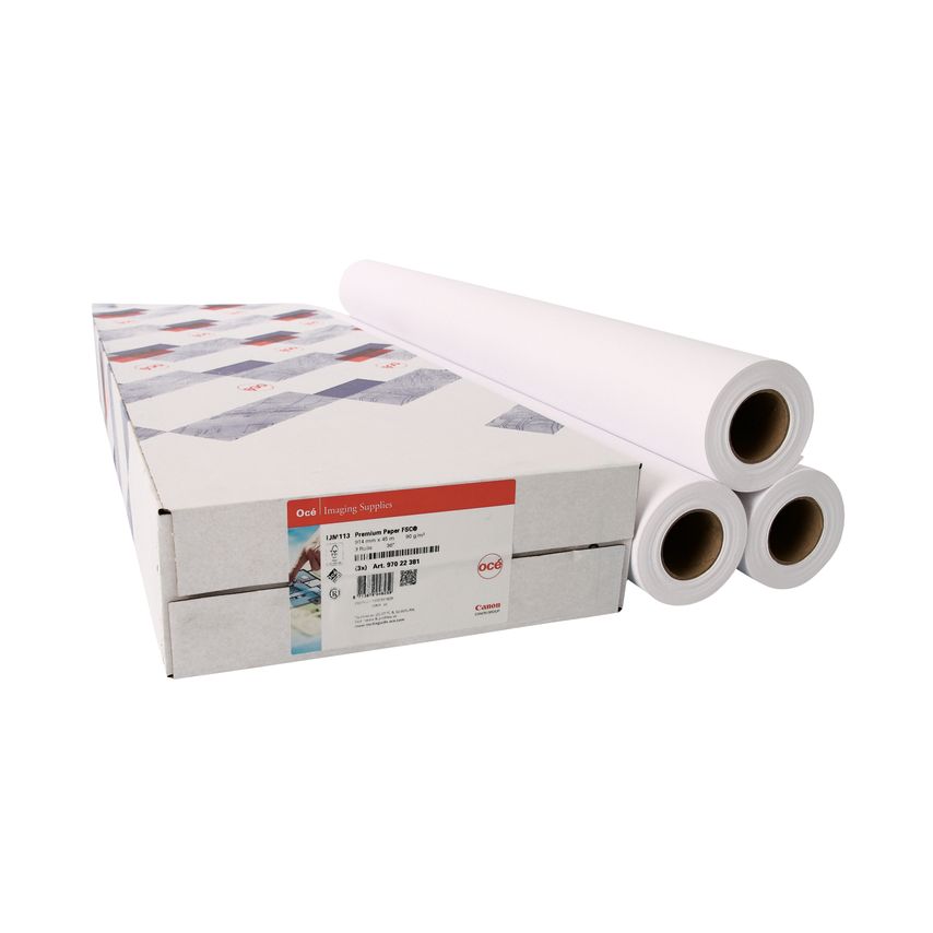
Canon Uncoated Standard InkJet Paper 914mm x 50m (Pack of 3) 97003448

Canon Coated Premium InkJet Paper Rolls 610mmx45m (Pack of 3) 97003451

Canon Coated Premium InkJet Paper Rolls 914mmx45m (Pack of 3) 97003449

Canon Coated Premium InkJet Paper Rolls 841mmx45m (Pack of 3) 97003450

Thematic Cartography and Geovisualization Fourth Edition

Thematic Cartography and Geovisualization Fourth Edition

This comprehensive and well-established cartography textbook covers the theory and the practical applications of map design and the appropriate use of map elements. It explains the basic methods for visualizing and analyzing spatial data and introduces the latest cutting-edge data visualization techniques. The fourth edition responds to the extensive developments in cartography and GIS in the last decade including the continued evolution of the Internet and Web 2. 0; the need to analyze and visualize large data sets (commonly referred to as Big Data); the changes in computer hardware (e. g. the evolution of hardware for virtual environments and augmented reality); and novel applications of technology. Key Features of the Fourth Edition: Includes more than 400 color illustrations and it is available in both print and eBook formats. A new chapter on Geovisual Analytics and individual chapters have now been dedicated to Map Elements Typography Proportional Symbol Mapping Dot Mapping Cartograms and Flow Mapping. Extensive revisions have been made to the chapters on Principles of Color Dasymetric Mapping Visualizing Terrain Map Animation Visualizing Uncertainty and Virtual Environments/Augmented Reality. All chapters include Learning Objectives and Study Questions. Provides more than 250 web links to online content over 730 references to scholarly materials and additional 540 references available for Further Reading. There is ample material for either a one or two-semester course in thematic cartography and geovisualization. This textbook provides undergraduate and graduate students in geoscience geography and environmental sciences with the most valuable up-to-date learning resource available in the cartographic field. It is a great resource for professionals and experts using GIS and Cartography and for organizations and policy makers involved in mapping projects. | Thematic Cartography and Geovisualization Fourth Edition

GBP 130.00
1

Spatial Pattern Dynamics in Aquatic Ecosystem Modelling UNESCO-IHE PhD Thesis

Agriculture and Climatic Issues in South Asia Geospatial Applications

Research on the Balance of Educational Resources Allocation and Spatial Layout

Space Movement and Visibility in Pompeian Houses

Strategies for Landscape Representation Digital and Analogue Techniques

Strategies for Landscape Representation Digital and Analogue Techniques

Strategies for Landscape Representation discusses a variety of digital and analogue production techniques for the representation of landscape at multiple scales. Careful consideration is required to represent time and to ensure accuracy of representation and evaluation in the landscape. Written as a guide for making appropriate selection of a wide variety of visualisation tools for students and built environment professionals with an interest in landscape the book charts emerging technologies and historical contexts whilst also being relevant to landscape legislation such as Building Information Modelling (BIM) and Landscape Assessment. This book is an innovation-driven text that encourages readers to make connections between software technology and analogue modes. The management choice and combination of such modes can arguably narrow the unknown of landscape character address the issues of representing time and change in landscape and engage and represent communities perceptions and experience of landscape. Showcasing international examples from landscape architecture planning urban design and architecture artists visualisers geographers scientists and model makers the vitality of making and intrinsic value of representational work in these processes and sites is evidenced. An accompanying companion website provides access to original source files and tutorials totalling over a hundred hours in mapping and GIS diagrams and notation photomontage 3D modelling and 3D printing. | Strategies for Landscape Representation Digital and Analogue Techniques

GBP 175.00
1

Biomass Burning in South and Southeast Asia Impacts on the Biosphere Volume Two

Biomass Burning in South and Southeast Asia Impacts on the Biosphere Volume Two

Biomass burning is one of the most important sources of greenhouse gas emissions and aerosols in South and Southeast Asia and greatly impacts other countries through transboundary air pollution. With contributions from leading scientists this volume offers an interdisciplinary perspective on the impacts of biomass burning on the land resources climate and the atmosphere. It showcases several examples linking top-down remote sensing bottom-up ground-based measurements and an integrated modeling to address the impacts of biomass burning and land–atmosphere interactions. It is a valuable guide for readers in atmospheric science ecology spatial geography remote sensing and GIS. This book is unique as it highlights the sources and the causes of biomass burning and atmospheric research in South and Southeast Asia. It explains the latest tools and techniques in particular the use of satellite remote sensing and geospatial technologies for fire mapping monitoring and land cover/land use change. It focuses on large spatial scales integrating top-down and bottom-up methodologies. It addresses the pressing issues of air pollution rampant in South and Southeast Asia. It includes contributions from global experts working on biomass burning projects in the USA Japan South/Southeast Asia and Europe. The contents of this book will appeal to students and professionals using remote sensing and geospatial techniques including geographers ecologists atmospheric and environmental scientists and all who are interested in biomass burning pollution. | Biomass Burning in South and Southeast Asia Impacts on the Biosphere Volume Two

GBP 140.00
1

Real-Time Environmental Monitoring Sensors and Systems - Textbook

Real-Time Environmental Monitoring Sensors and Systems - Textbook

Written 10 years after the publication of the first edition this updated edition of Real-Time Environmental Monitoring: Sensors and Systems introduces the fundamentals of environmental monitoring based on electronic sensors instruments systems and software that allow continuous and long-term ecological and environmental data collection. It accomplishes two objectives: explains how to use sensors for building more complex instruments systems and databases and introduces a variety of sensors and systems employed to measure environmental variables in air water soils vegetation canopies and wildlife observation and tracking. This second edition is thoroughly updated in every aspect of technology and data and each theoretical chapter is taught parallel with a hands-on application lab manual. Emphasizes real-time monitoring as an emerging area for environmental assessment and compliance and covers the fundamentals on how to develop sensors and systems Presents several entirely new topics not featured in the first edition including remote sensing and GIS machine learning weather radar and satellites groundwater monitoring spatial analysis and habitat monitoring Includes applications to many environmental and ecological systems Uses a practical hands-on approach with the addition of an accompanying lab manual which students can use to deepen their understanding based on the author’s 40 years of academic experience Intended for upper-level undergraduate and graduate students taking courses in civil and environmental engineering electrical engineering mechanical engineering geosciences and environmental sciences as well as professionals working in environmental services and researchers and academics in engineering. | Real-Time Environmental Monitoring Sensors and Systems - Textbook

GBP 89.99
1

Practical Research Methods for Nonprofit and Public Administrators

Practical Research Methods for Nonprofit and Public Administrators

Practical Research Methods for Nonprofit and Public Administrators Second Edition covers basic principles of research design data collection data analysis reporting and ethical principles of research. The discussion describes the skills as they would be used in practice in a not-for-profit or public administration environment. The book gives pragmatic instructions for designing research to ensure that results will be accurate and administrators can have confidence in them. It covers techniques to assure that researchers are measuring what they intend to measure and in a way that will be useful and manageable. Sampling methods to find out about larger populations are discussed as are survey interview and focus group data collection procedures. The book describes how Geographic Information Systems (GIS) are used to obtain information on the locations of service needs and providers and to draw maps showing these. Participatory research methods including community needs assessments and asset mapping are discussed. The book includes chapters on statistical analysis visual displays of data reporting of results and evaluation of programs. The use of computer programs for analyzing data is detailed and illustrated by examples. The appropriate software for analysis and mapping is discussed. A chapter updates the ethics and government requirements for research. Each chapter includes examples and exercises to enhance learning. The book is intended for administrators in not-for-profit and public administration organizations providing practical skills that can be used in many situations. It is also intended for use as a text in academic programs in administration and management.

GBP 94.99
1