22 results (0,17090 seconds)

Brand

Colour

Merchant

Price (EUR)

Reset filter

Products
From
Shops

Archaeological 3D GIS

GIS in Sustainable Urban Planning and Management A Global Perspective

GIS in Sustainable Urban Planning and Management A Global Perspective

The Open Access version of this book available at http://www. tandfebooks. com/doi/view/10. 1201/9781315146638 has been made available under a Creative Commons Attribution-Non Commercial-No Derivatives 3. 0 license. GIS is used today to better understand and solve urban problems. GIS in Sustainable Urban Planning and Management: A Global Perspective explores and illustrates the capacity that geo-information and GIS have to inform practitioners and other participants in the processes of the planning and management of urban regions. The first part of the book addresses the concept of sustainable urban development its different frameworks the many ways of measuring sustainability and its value in the urban policy arena. The second part discusses how urban planning can shape our cities examines various spatial configurations of cities the spread of activities and the demands placed on different functions to achieve strategic objective. It further focuses on the recognition that urban dwellers are increasingly under threat from natural hazards and climate change. Written by authors with expertise on the applications of geo-information in urban management this book showcases the importance of GIS in better understanding current urban challenges and provides new insights on how to apply GIS in urban planning. It illustrates through real world cases the use of GIS in analyzing and evaluating the position of disadvantaged groups and areas in cities and provides clear examples of applied GIS in urban sustainability and urban resilience. The idea of sustainable development is still very much central in the new development agenda of the United Nations and in that sense it is of particular importance for students from both the Global South and Global North. Professionals researchers and students alike will find this book to be an invaluable resource for understanding and solving problems relating to sustainable urban planning and management. | GIS in Sustainable Urban Planning and Management A Global Perspective

GBP 42.99
1

Enterprise GIS Concepts and Applications

Focus and Background Marking in Mandarin Chinese System and Theory behind cai jiu dou and ye

GIS Cartography A Guide to Effective Map Design Third Edition

GIS Cartography A Guide to Effective Map Design Third Edition

Since the publication of the bestselling second edition 5 years ago vast and new globally-relevant geographic datasets have become available to cartography practitioners and with this has come the need for new ways to visualize them in maps as well as new challenges in ethically disseminating the visualizations. With new features and significant updates that address these changes this edition remains faithful to the original vision that cartography instruction should be software agnostic. Discussing map design theory and technique rather than map design tools this book focuses on digital cartography and its best practices. This third edition has completely new sections on how to deal with maps that go viral and the ethics therein; new presentation ideas; new features such as amenities climate data and hazards; the new Equal Earth projection; and vector tile design considerations. All chapters are thoroughly updated with new illustrations and new sections for datasets that didn’t exist when the second edition was published as well as new techniques and trends in cartography. New in the third edition: A true textbook written with a friendly style and excellent examples explaining everything from layout design to fonts and colors to specific design considerations for individual feature types to static and dynamic cartography issues. Thoroughly updated with new features such as points of interest climate data hazards and buildings; new projections such as the Equal Earth projection and the Spilhaus projection; and vector tile design considerations such as label placement techniques and tricks for making world-class basemaps. Includes over 70 new map examples that display the latest techniques in cartography. Reflects on new developments in color palettes; visualization patterns; datums; and non-static output media such as animation interaction and large-format cinematic techniques that weren’t available for the second edition. Defines and illustrates new terms that have made their way into the profession over the last few years such as story maps flow maps Dorling cartograms spec sheets bivariate choropleths firefly cartography Tanaka contours and value-by-alpha. In this third edition author Gretchen Peterson takes a don’t let the technology get in the way approach to the presentation focusing on the elements of good design what makes a good map and how to get there rather than specific software tools. She provides a reference that you can thumb through time and again as you create your maps. Copiously illustrated the third edition explores novel concepts that kick-start your pursuit of map-making excellence. The book doesn’t just teach you how to design and create good maps it teaches you how to design and create superior maps. | GIS Cartography A Guide to Effective Map Design Third Edition

GBP 39.99
1

MMA Team Manager Steam CD Key

MMA Team Manager Steam CD Key

MMA Team Manager is the all new, face punching, body slamming manager game for the real MMA fans. Experience the life as a manager running your own team and leading the fighters to worldwide glory in the cage. Fight your way through gruelling season after season across numerous leagues, with over 100 teams and take part in world wide knock-out events which tests your managing ability to the absolute limit. Incorporating a feature packed 3D fight engine that includes dynamic AI decisions and with up to 100 motion captured animations, this brings the real-life brutality of the cage right to your finger tips. Key Features: Experience the roughness of live MMA cage fighting, with the ability to change tactics in fight, to overcome your opponents utilising MMA techniques. Select from over 100 clubs of fighters from around the globe. Upgrade able facilities lets you keep your fighters in top form ready for the competitions. Train, hone and grade your fighters in an array of traditional striking martial arts, including Boxing, Karate, Tai Kwon Do and Thai Boxing. Train, hone and grade your fighters in an array of traditional grappling martial arts, including Brazilian Jiu Jitsu, Judo, Olympic Wrestling and Shoot Fighting. Hire and fire coaches and physios to mould your club into a competitive team of elite fighters. Team based MMA with 7 leagues, involving promotion & relegation, cup and shield competitions. Find, recruit and nurture young talent before promoting to the senior ranks for competitive selection.

GBP 23.81
1

Canon Uncoated Standard InkJet Paper 915mm x 91m 97024845

Spatial Statistics GeoSpatial Information Modeling and Thematic Mapping

Spatial Statistics GeoSpatial Information Modeling and Thematic Mapping

Geospatial information modeling and mapping has become an important tool for the investigation and management of natural resources at the landscape scale. Spatial Statistics: GeoSpatial Information Modeling and Thematic Mapping reviews the types and applications of geospatial information data such as remote sensing geographic information systems (GIS) and GPS as well as their integration into landscape-scale geospatial statistical models and maps. The book explores how to extract information from remotely sensed imagery GIS and GPS and how to combine this with field data—vegetation soil and environmental—to produce a spatial model that can be reconstructed and displayed using GIS software. Readers learn the requirements and limitations of each geospatial modeling and mapping tool. Case studies with real-life examples illustrate important applications of the models. Topics covered in this book include:An overview of the geospatial information sciences and technology and spatial statistics Sampling methods and applications including probability sampling and nonrandom sampling and issues to consider in sampling and plot design Fine and coarse scale variabilitySpatial sampling schemes and spatial patternLinear and spatial correlation statistics including Moran’s I Geary’s C cross-correlation statistics and inverse distance weightingGeospatial statistics analysis using stepwise regression ordinary least squares (OLS) variogram kriging spatial auto-regression binary classification trees cokriging and geospatial models for presence and absence data How to use R statistical software to work on statistical analyses and case studies and to develop a geospatial statistical model | Spatial Statistics GeoSpatial Information Modeling and Thematic Mapping

GBP 42.99
1

Canon Uncoated Standard InkJet Paper 841mm x 91m 97024714

The Transformation of EU Geographical Indications Law The Present Past and Future of the Origin Link

The Transformation of EU Geographical Indications Law The Present Past and Future of the Origin Link

Linking traditional and local products to a specific area is increasingly felt as a necessity in a globalised market and Geographical Indications (GIs) are emerging as a multifunctional tool capable of performing this and many other functions. This book analyses the evolving nature of EU sui generis GIs by focusing on their key element the origin link and concludes that the history of the product in the broad sense has become a major factor to prove the link between a good and a specific place. For the first time this area of Intellectual Property Law is investigated from three different although interrelated perspectives: the history and comparative assessment of the systems of protection of Indications of Geographical Origin adopted in the European jurisdictions from the beginning of the 20th century; the empirical analysis of the trends emerging from the practice of EUGIs; and the policy debates surrounding them and their importance for the fulfilment of the general goals of the EU Common Agricultural Policy. The result is an innovative and rounded analysis of the very nature of the EU Law of GIs that starting from its past investigates the present and the likely future of this Intellectual Property Right. This book provides an interesting and innovative contribution to the field and will be of interest to GI scholars and Intellectual Property students as well as anyone willing to gain a better understanding of this compelling area of law. | The Transformation of EU Geographical Indications Law The Present Past and Future of the Origin Link

GBP 36.99
1

Deep Learning for Remote Sensing Images with Open Source Software

Deep Learning for Remote Sensing Images with Open Source Software

In today’s world deep learning source codes and a plethora of open access geospatial images are readily available and easily accessible. However most people are missing the educational tools to make use of this resource. Deep Learning for Remote Sensing Images with Open Source Software is the first practical book to introduce deep learning techniques using free open source tools for processing real world remote sensing images. The approaches detailed in this book are generic and can be adapted to suit many different applications for remote sensing image processing including landcover mapping forestry urban studies disaster mapping image restoration etc. Written with practitioners and students in mind this book helps link together the theory and practical use of existing tools and data to apply deep learning techniques on remote sensing images and data. Specific Features of this Book: The first book that explains how to apply deep learning techniques to public free available data (Spot-7 and Sentinel-2 images OpenStreetMap vector data) using open source software (QGIS Orfeo ToolBox TensorFlow) Presents approaches suited for real world images and data targeting large scale processing and GIS applications Introduces state of the art deep learning architecture families that can be applied to remote sensing world mainly for landcover mapping but also for generic approaches (e. g. image restoration) Suited for deep learning beginners and readers with some GIS knowledge. No coding knowledge is required to learn practical skills. Includes deep learning techniques through many step by step remote sensing data processing exercises.

GBP 31.99
1

Visualizing Venice Mapping and Modeling Time and Change in a City

DreamWorks Trolls Remix Rescue Steam Account
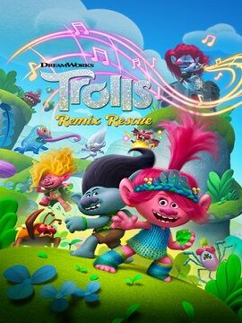
Gentrification Trends in the United States

How to Make Maps An Introduction to Theory and Practice of Cartography

How to Make Maps An Introduction to Theory and Practice of Cartography

The goal of How to Make Maps is to equip readers with the foundational knowledge of concepts they need to conceive design and produce maps in a legible clear and coherent manner drawing from both classical and modern theory in cartography. This book is appropriate for graduate and undergraduate students who are beginning a course of study in geospatial sciences or who wish to begin producing their own maps. While the book assumes no a priori knowledge or experience with geospatial software it may also serve GIS analysts and technicians who wish to explore the principles of cartographic design. The first part of the book explores the key decisions behind every map with the aim of providing the reader with a solid foundation in fundamental cartography concepts. Chapters 1 through 3 review foundational mapping concepts and some of the decisions that are a part of every map. This is followed by a discussion of the guiding principles of cartographic design in Chapter 4—how to start thinking about putting a map together in an effective and legible form. Chapter 5 covers map projections the process of converting the curved earth’s surface into a flat representation appropriate for mapping. Chapters 6 and 7 discuss the use of text and color respectively. Chapter 8 reviews trends in modern cartography to summarize some of the ways the discipline is changing due to new forms of cartographic media that include 3D representations animated cartography and mobile cartography. Chapter 9 provides a literature review of the scholarship in cartography. The final component of the book shifts to applied technical concepts important to cartographic production covering data quality concepts and the acquisition of geospatial data sources (Chapter 10) and an overview of software applications particularly relevant to modern cartography production: GIS and graphics software (Chapter 11). Chapter 12 concludes the book with examples of real-world cartography projects discussing the planning data collection and design process that lead to the final map products. This book aspires to introduce readers to the foundational concepts—both theoretical and applied—they need to start the actual work of making maps. The accompanying website offers hands-on exercises to guide readers through the production of a map—from conception through to the final version—as well as PowerPoint slides that accompany the text. | How to Make Maps An Introduction to Theory and Practice of Cartography

GBP 35.99
1

Across the Corrupting Sea Post-Braudelian Approaches to the Ancient Eastern Mediterranean

Electric Field Analysis

Place Attachment Advances in Theory Methods and Applications

Place Attachment Advances in Theory Methods and Applications

Following on from the ground-breaking first edition which received the 2014 EDRA Achievement Award this fully updated text includes new chapters on current issues in the built environment such as GIS and mapping climate change and qualitative approaches. Place attachments are powerful emotional bonds that form between people and their physical surroundings. They inform our sense of identity create meaning in our lives facilitate community and influence action. Place attachments have bearing on such diverse issues as rootedness and belonging placemaking and displacement mobility and migration intergroup conflict civic engagement social housing and urban redevelopment natural resource management and global climate change. In this multidisciplinary book Manzo and Devine-Wright draw together the latest thinking by leading scholars from around the globe including contributions from scholars such as Daniel Williams Mindy Fullilove Randy Hester and David Seamon to capture significant advancements in three main areas: theory methods and applications. Over the course of fifteen chapters using a wide range of conceptual and applied methods the authors critically review and challenge contemporary knowledge identify significant advances and point to areas for future research. This important volume offers the most current understandings about place attachment a critical concept for the environmental social sciences and placemaking professions. | Place Attachment Advances in Theory Methods and Applications

GBP 42.99
1

Viking Silver Hoards and Containers The Archaeological and Historical Context of Viking-Age Silver Coin Deposits in the Baltic c. 800–1050

Viking Silver Hoards and Containers The Archaeological and Historical Context of Viking-Age Silver Coin Deposits in the Baltic c. 800–1050

It is widely accepted that the Viking Age (c. 800–1050) stimulated the development of long-distance regional and local trade and exchange networks. The clearest archaeological evidence for these contacts is mainly in the form of silver artefacts predominantly found in hoards in Northern and Central Europe – the Baltic zone. However beyond occasional national- or regional-level research there have been no attempts at a historically guided comparative archaeological survey of the Baltic zone as a whole. By investigating silver hoards and the context of their deposition Viking Silver Hoards and Containers seeks to understand the variety of functions performed by hoards; the differences in function within regions; the hoards’ relationship with trade; and the nature and function of emporia. It also examines the extent to which the findings mesh with literary evidence and the nature of the different societies benefiting from the influx of silver in the Viking Age. Crucially the book features a catalogue which provides a thorough overview and update of Baltic-zone hoards. Viking Silver Hoards and Containers is intended for use by students of and specialists in early medieval Viking and Slavic history and archaeology. However it will also be a useful teaching resource for other general courses in archaeology anthropology and material culture numismatics economic history religious studies GIS and statistics. | Viking Silver Hoards and Containers The Archaeological and Historical Context of Viking-Age Silver Coin Deposits in the Baltic c. 800–1050

GBP 39.99
1

Critical Race Spatial Analysis Mapping to Understand and Address Educational Inequity

Critical Race Spatial Analysis Mapping to Understand and Address Educational Inequity

How does space illuminate educational inequity?Where and how can spatial analysis be used to disrupt educational inequity?Which tools are most appropriate for the spatial analysis of educational equity?This book addresses these questions and explores the use of critical spatial analysis to uncover the dimensions of entrenched and systemic racial inequities in educational settings and identify ways to redress them. The contributors to this book – some of whom are pioneering scholars of critical race spatial analysis theory and methodology – demonstrate the application of the theory and tools applied to specific locales and in doing so illustrate how this spatial and temporal lens enriches traditional approaches to research. The opening macro-theoretical chapter lays the foundation for the book rooting spatial analyses in critical commitments to studying injustice. Among the innovative methodological chapters included in this book is the re-conceptualization of mapping and space beyond the simple exploration of external spaces to considering internal geographies highlighting how the privileged may differ in socio-spatial thinking from oppressed communities and what may be learned from both perspectives; data representations that allow the construction of varied narratives based on differences in positionality and historicity of perspectives; the application of redlining to the analysis of classroom interactions; the use of historical archives to uncover the process of marginalization; and the application of techniques such as the fotonovela and GIS to identify how spaces are defined and can be reimagined. The book demonstrates the analytical and communicative power of mapping and its potential for identifying and dismantling racial injustice in education. The editors conclude by drawing connections across sections and elucidating the tensions and possibilities for future research. ContributorsBenjamin BlaisdellGraham S. GarlickLeigh Anna HidalgoMark C. HogrebeJoshua RadinskyDaniel G. SolórzanoWilliam F. TateVerónica N. VélezFederico R. Waitoller | Critical Race Spatial Analysis Mapping to Understand and Address Educational Inequity

GBP 32.99
1

Visual Criminology From History and Methods to Critique and Policy Translation

Visual Criminology From History and Methods to Critique and Policy Translation

This edited collection captures the expertise of scholars from the US the UK Australia and Canada to catalog the rise in visual approaches in criminology. It presents examples of visual methods uses and approaches in criminology; assesses the potential for new graphic approaches to collect analyze and present data; and provides some analysis of the use of images in teaching to spur social critique and guide policy translation. The collection visually connects theory and practice by highlighting the work of criminologists who have embraced the visual turn. Contributors explore the use of cognitive maps concept and mind maps life history calendars CCTV life plots GIS and hot spot research policy graphs visual abstracts and research summaries and other visual tools in the context of criminology. Approaches building on visual sociology are also featured including a discussion of developments in documentary photography and film visual ethnography and sensory phenomenology. The book is organized thematically with each chapter following logically upon the last introducing readers to a variety of visual approaches and their application in criminology. The goals of this collected volume are three-fold. The first is to highlight how the visual has been used in criminology historically to present data contest meaning and complicate social control and make more transparent the research process. The second is to work toward some sort of definitional consistency. While a worthy endeavor this remains elusive given the assortment of uses and varying traditions from which visual criminology has emerged. The third is to try to think clearly about the role of humility. This means a willingness to acknowledge an epistemological framework and note the variety of limitations associated with trying to understand in deep and meaningful ways. For visual criminology specifically it involves the recognition that part of the power of images (whatever their construction) comes from whether we think they are beautiful or whether and/or to what extent they disrupt our understanding in one way or another. This interdisciplinary book will be of interest to criminologists sociologists visual ethnographers historians and those engaged with media studies. It is a valuable supplementary text for courses in introductory criminology and criminal justice criminological theory research methods and other upper-level and senior capstone courses. | Visual Criminology From History and Methods to Critique and Policy Translation

GBP 39.99
1